News archive
Media enquiries: 1800 882 035
Email: media@ga.gov.au
These contacts are for members of the media only. Enquiries from the general public are best managed via our other contact points.

Australia joins the world in raising tsunami awareness
4 November 2016
In the lead up to the first World Tsunami Awareness Day on Saturday, 5 November 2016, the Joint Australian Tsunami Warning Centre (JATWC) is reminding Australians what to do if a tsunami warning is issued in their area.
Building Australia's capacity to estimate the impact of terrorist blasts
31 October 2016
Building upon its existing natural hazard modelling expertise, Geoscience Australia has developed a capability which helps estimate the potential impact of terrorist blasts across a number of Australian central business districts (CBDs).Making 3D maps: 2016 GovHack winners announced
24 October 2016
This year's GovHack winners have been announced at the 2016 GovHack Red Carpet Awards held in Adelaide on Saturday 22 October. Geoscience Australia is proud to support open data through our ongoing support of the GovHack competition.
Applying science to disaster risk reduction
13 October 2016
Geoscience Australia is joining organisations from around the world today in recognising the International Day for Disaster Reduction.
Earth Science Week October 2016
5 October 2016
Earth Science Week is just around the corner. Join the celebrations from 9-15 October for a great opportunity to explore the natural world around you and celebrate the raw natural beauty of our nation's geology.
Geoscience Australia partners with Google to showcase Australia's natural history
14 September 2016
Geoscience Australia's never-before-seen collections are now available online, as part of the Google Cultural Institute's launch of more than 50 natural history collections from around the globe.
Environmental monitoring project measures surface movement using satellite data
7 September 2016
Geoscience Australia and the NSW Department of Industry's Division of Resources and Energy are using the latest satellite technology to measure potential ground movement in the Macarthur region, south of Sydney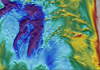
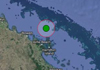
Exploring the marine secrets of Northern Territory's Bynoe Harbour
26 August 2016
A team of marine scientists have completed a marine mapping survey of the sea floor of Bynoe Harbour in the Northern Territory, building on the existing knowledge and understanding of this unique seabed habitat.
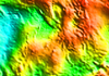
Updated gravity datasets deliver a treasure map for mineral and energy exploration
22 August 2016
Australia now has a full suite of new gravity grids at the national scale, being the first publically released since 2011.