


Groundwater shines a light on hidden mineralisation
20 December 2018
Geoscience Australia, as part of the Exploring for the Future (EFTF) program, undertook an extensive groundwater survey across the Tennant Creek and the McArthur Basin region to better understand where potential resources may be buried.
During the 2017 dry season, 118 groundwater samples were collected to locate new mineral areas for further investigation and establish environmental baselines. Examining chemical elements in groundwater is an effective way to identify mineral and energy resources buried deep under cover. As groundwater moves through the Earth and interacts with bedrock and aquifers, various chemical elements can be dissolved into the water, providing clues about what is hidden beneath the surface.
The samples were tested for over 120 inorganic and organic chemical elements, compounds and isotopes present in the groundwater including metals such as copper, gold, lead, silver and zinc.
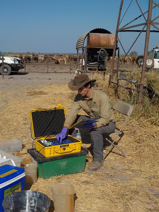
Groundwater samples being tested in the Barkly Tablelands, Northern Territory.
Early results indicate that there may be new mineral targets such as copper over the survey region. Comparison of these data with the results from a soil geochemical survey over the same region in 2017 shows a strong correlation in areas with high copper concentrations. Further research is underway to analyse the data in more detail and map areas where the groundwater is high in various base metals. This is valuable data that can help mineral exploration companies investigate new prospective areas.
Geoscience Australia is applying machine learning to the groundwater and soil geochemistry data to produce high-spatial-resolution mineral prediction maps. Initial results show copper measured in groundwater closely matches the copper predicted by machine learning and may further shed light on buried mineral systems. The new data also provide environmental information that can be used to assess the impacts of any future development in the area.
The new report (Wallace et al., 2018) and downloadable data package are available from Geoscience Australia's Hydrochemistry portal. Detailed interpretations of the mineral potential, environmental information and groundwater flow systems will be released in late 2019. The groundwater sampling survey was undertaken with support from the Northern Territory Geological Survey.
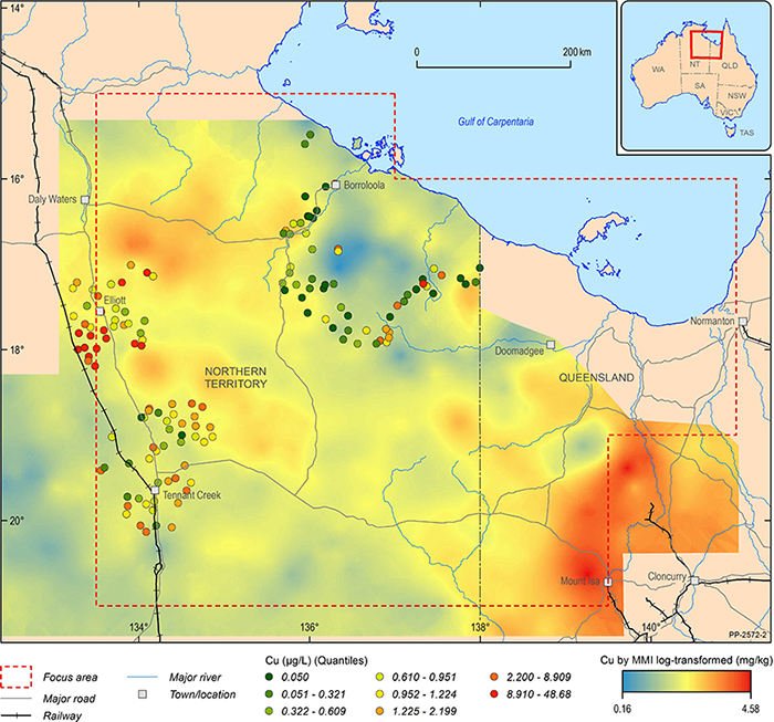
Map showing the distribution of copper in groundwater and soils over the Tennant Creek and the McArthur Basin region survey area.
Geoscience Australia has been acquiring and delivering geoscience data and information to Government and industry for more than 70 years, building a knowledge base that has led industry to make numerous mineral and petroleum discoveries.
For more information about Exploring for the Future visit www.ga.gov.au/eftf